
LOCAL CHARACTER | DESIGN AND CHARACTER IN THE HIGH STREET | HISTORIC BUILDINGS | SUSTAINABLE DESIGN | NATURAL ENVIRONMENT | LANDSCAPE BUFFERS
PURPOSES
The purposes of the policies in this section are:
-
Ensuring a place-making approach to development, to ensure that it is sustainable, well-designed and creates a distinctive local identity.
-
Protecting or enhancing the historic, natural and rural environments of the civil parish of Ongar.
-
Protecting the existing unique character of the built form including overall layout and design, vernacular style, local materials, architectural details etc. as defined in Ongar Design Guide 2019 (AECOM)
The policies in this chapter and in conjunction with all the policies on Rural Regeneration and Community and Transport Infrastructure need to be read and applied collectively.
RATIONALE: LOCAL CHARACTER AND DESIGN
Design for any new development in Ongar should start with an appreciation of the existing local character.47 New developments will be expected to complement and enhance local character to provide well designed places where cars do not dominate the street scene. [48]
The character of the civil parish of Ongar is primarily defined by its historic core of Chipping Ongar High Street. Of medieval origin, the town enclosure is situated on a ridge with glimpses to the surrounding open, sparsely populated countryside. Mostly unchanged, Chipping Ongar and its neighbouring settlements of Marden Ash and Shelley experienced some 20th century development which largely respected the rural nature of the parish with low rise homes, wide grass verges, many being tree lined and open views to the countryside.
These historic buildings are an essential part of the character of Ongar and were mentioned in the Conservation Area Appraisal in 1998.


Overall layout and design, vernacular style and materials as well as architectural details used over the centuries determines local character. Protecting that unique character as a small historic town in an open rural setting is particularly important to the community. Any new development must apply the guidelines in Ongar Design Guide 2019 [49] together with the National Design Guide 2021, and National Model Design Code 2021 in their detailed planning, as well as information in Essex Design Guide. This is especially important because EFDC Local Plan includes an increase in housing stock for Ongar, by up to a third in a short space of time
The Character of today’s Civil Parish of Ongar is still rural in nature and defined by low rise, low density, with an openness, green verges and views of the surrounding countryside in all residential parts of the civil parish. The town centre of Chipping Ongar has a more enclosed built-up character [50], although still only 2 or 3 storey buildings, depending largely on their historic importance. It retains glimpses to open countryside emphasising its rural location. Chipping Ongar was an important market town as long ago as the Medieval era, the administrative centre of the Saxon Ongar Hundred, and has the remains of a Norman motte and bailey castle surrounded by countryside
The varied architectural styles in the civil parish of Ongar reflects its gradual development since Medieval times to the present day and includes Georgian and Queen Anne Mansions, thatched cottages, typical 18th century workers’ cottages and more ornate artisan, timber framed and brick-built dwellings. The railway service to London opened in 1865 and brought a variety of public Victorian buildings, including a police station (now demolished), and Budworth Hall.
Ongar Design Guide (AECOM 2019) sets out the positive aspects of character for different parts of the parish and gives clear guidelines for a general approach to layout and other built elements that apply to all character areas. It also sets out the design and detail that is typical of each part of the Civil Parish, including its two Conservation Areas and other Heritage Assets. All these factors contribute to the local unique character of the area and is valued by the local community. Ongar Design Guide includes: Townscape structure; Green spaces; Public realm and streetscape; Pattern and layout of buildings; Building line and boundary treatments; Views and landmarks; Building heights and roofline; Building modifications, extension and plot infill; Architectural details; and Materials. The National Design Guide rev. ed. 2021 emphasises the need to relate local vernacular, including the type of layout according to rural and edge of settlement design. (EFDC allocated sites for Ongar fall into the “edge of settlement” and “town centre” designs p19) Essex Design Guide reiterates this.
The elements in the National Design Guide 2021 and the National Model Design Code 2021 [51] supports the content of Ongar Design Guide and quotes “Good design involves careful attention to other important components of places [in addition to buildings]. These include:
-
The context for places and buildings;
-
Hard and soft landscape;
-
Technical infrastructures, transport, utilities, services such as drainage; and
-
Social infrastructure-social, commercial, leisure uses and activities.”
Those ‘important components’ include: layout, form and scale, appearance, landscape, materials and detailing. Ongar Design Guide specifies these in relation to local context, with particular characteristics and design requirements of the civil parish of Ongar to be followed. “When considering the layout, grain and scale of the buildings and spaces in different locations, traditional street patterns help create new developments that fit well into the surrounding context” rather than a bolt on addition. Furthermore, National Design Guide p19 has diagrams for ‘centre’ and ‘edge’ which apply to Ongar and should be used. Local context and good design should lead to the best use of land, including density. Paragraphs 65, 66, and 67 of National Design Guide state:
“65 – Well-designed new development makes efficient use of land with an amount and mix of development and open space that optimises density. It also relates well to and enhances the existing character and context.
66 – Built form is determined by good urban design principles that combine layout, form and scale in a way that responds positively to the context. The appropriate density will result from the context, accessibility, the proposed building types, form and character of the development.
67 – Well-designed places also use the right mix of building types, forms and scale of buildings and public spaces to create a coherent form of development that people enjoy. They also adopt strategies for parking and amenity that support the overall quality of the place. “
Chapter 11 of the NPPF 2021 makes it clear that policies and decisions should promote effective use of land for meeting the need for homes, but also other uses while safeguarding and improving the environment and ensuring safe and healthy living conditions (Paragraph 119). These other uses are explained more in Paragraph 120 which includes effective use of land as being mixed use schemes for example or developments that would enable new habitat creation or improve public access to the countryside (120 a); that some undeveloped land can function, amongst other uses, as flood risk mitigation (120 b). On achieving appropriate densities in Para 124, the NPPF supports efficient use of land taking account of various factors including the identified need for different types of housing (part a), local market conditions and viability (part b)), the availability and appropriateness of infrastructure (part c)) and part d) “the desirability of maintaining an area’s prevailing character and setting”. Paragraph 120 part e) also indicates that policies and decisions should support upward extensions “where the development would be consistent with the prevailing height and form of neighbouring properties and the overall street scene”. This implies that it is inappropriate unless those criteria are met. Additionally, the impact on any heritage assets would need to be carefully considered.”
Community engagement confirmed that local people appreciate the rural landscape, with over 90% of the Residents Survey respondents [52] wanting to maintain the rural setting, provide additional trees and green corridors and protect the natural environment. The latter is covered in Section 7.6 The Natural Environment to achieve these aspirations.
Good design, which complies with Government thinking, Frameworks, Guidance and Reports [53] will lead to “Neighbourhoods create places not just houses”. Living with Beauty 2020 recognises that the model of development from ‘building units’ needs to change to ‘making places’. This will ensure that place shaping within developments will lead from good layouts in appropriate design, open spaces, private amenity space, natural surveillance, recreational areas etc. and neighbourhoods with street scenes not dominated by cars. This in turn leads to efficient use of land.
For Ongar’s allocated sites, it is expected that the place shaping principles will be the starting point. Considerations of the local character and context, constraints of the site, the character of the location (e.g. open rural edge of settlement or town centre enclosed), housing mix requirements and community spaces or facilities on the site will determine the eventual numbers of homes and appropriate density. Although EFDC Local Plan does give approximate housing numbers for the Strategic Sites ONG R1-ONG R8, final numbers can only be determined after justification in applying these other factors, as per Paragraph 65 of National Design Guide During EFDC’s examination process, The Inspector [54] acknowledged that numbers on most strategic sites must be flexible because many sites still had to have more accurate assessment of physical, ecological and environment constraints. Rigidity on numbers must not predetermine the design of the site which could lead to inappropriate character, housing mix, density, massing, open green space, etc. Mistakes of the past must be avoided. See also Section 6.4 Housing Mix and Standards and Policy ONG-RR3 and EFDC statement on Housing Mix and densities for Ongar sites [55]
Landscaping with trees and hedging will be expected and existing trees should be retained. Where tree loss is unavoidable, such as through disease, replacement trees must be provided elsewhere on the site. New planting will be expected to use indigenous species which support insect life and native animal food chains. See also Section 7.6 Natural Environment and Policy ONG-ED5
‘Passive’ housing and other design and materials supporting green issues and carbon reduction is encouraged.
POLICY ONG-ED1: LOCAL CHARACTER AND DESIGNS
Policy ONG-ED1: Local Character And Design
-
New-build development, including extensions, and alterations to existing dwellings must complement the rural character of the Ongar Parish and the specific character of the immediate context as outlined in Ongar Design Guide, creating a locally distinctive sense of place. This includes:
-
Complementing the existing rural ‘townscape’ character in terms of height, scale, massing, and degree of set-back of building frontages from the road in accordance as to whether the development is in the town centre of Chipping Ongar, infill of the built up area, edge of settlement of the surrounding rural villages and hamlets of Shelley, Marden Ash and Greensted or in the countryside ;
-
Using high quality and durable materials, with a high standard of finish, with locally indigenous materials, in particular, being welcomed;
-
Retaining existing trees and hedges, wherever it is practicable to do so, as well as including new planting, including in the street scene, using native local species;
-
Using hedges or low-level masonry walls constructed of local materials for front boundary treatments wherever possible and appropriate in the context of the scheme’s overall design;
-
Incorporating landscape buffers or landscaped edges or features, to create a soft transition for development on the edge of rural areas to mitigate the impact on the surrounding countryside;
-
Incorporating views and glimpses to surrounding countryside in layout and form of development.
-
Include tree-lined streets unless in specific cases there are clear, justifiable and compelling reasons why this would be inappropriate, and include trees elsewhere within developments where the opportunity arises.
-
-
Innovative and creative design solutions designed for the specific site and context will be welcomed. This includes development that has a high standard of environmental performance.
INTERPRETATION OF ONG-ED1
This should be considered particularly with Policy ONG-RR3 Housing Mix and Standards, which includes density, Policy ONG-ED4 Sustainable Design, and Policy ONG-CT3 Transport and Movement which includes parking provision, as well as the other design and environment policies in this Chapter .
Policy ONG-ED1 aims to promote high quality buildings that complement the existing townscape characteristics of the area, using place shaping principles and appropriate layout, scale and grain, and to include open spaces within new developments. Details within Ongar Design Guide [56] and relevant sections of the National Design Guide 2019 [57], National Model Design Code 2021 and Essex Design Guide should be applied. Specifically, there should be a move away from car dominated streets in residential areas, with better solutions for car parking and cycle provision using Essex Design Guide and Essex Parking Standards 2009. Car parking policy is covered in Transport and Movement and Policy CT3
The policy is not intended to suppress creativity or to require stylistic imitation. The design of new buildings should reflect the design trends and principles of their time, so that the rich diversity of local character continues and is extended into the future. Indeed, the new buildings most likely to be perceived as heritage in the future would be likely to be the more creative and innovative examples.
To allow for proper consideration of development proposals, new buildings and extensions should be shown on plans relative to existing buildings, including 3D visuals. The design and access statement and, where applicable, heritage statement provide opportunities to explain how the requirements of the policy have been complied with including from Ongar Design Guide and the National Design Guide and National Model Design Code.
See also Section 7.6 Natural Environment and Policy ONG-ED5 relating to trees and vegetation within new developments and Section 7.7 rationale Landscape Buffers and Policy ONG-ED6
RATIONALE: DESIGN AND CHARACTER IN THE HIGH STREET
Chipping Ongar Conservation Area covers the medieval town enclosure with Ongar Castle, St Martin’s Church, the High Street and immediate environs from Ongar Bridge in the south to Central House and Hermitage Cottage to the north. The definition of streets and spaces, public and private realm, are very distinct in the central part of Chipping Ongar with a clear sense of enclosure along a widened main street of a type found in many English market towns originating during the Saxon period. The character of the High Street derives from strong building lines, the gentle curvature of the street offering a series of attractive vistas, ‘pinch point’ buildings marking entry and exit points to the former town enclosure, views into the surrounding countryside and prominent public buildings which form local landmarks.
The form and layout of the historic core of Chipping Ongar has changed little since the medieval period, although a small residential estate was built behind the United Reform Church via Stanley Place in the late 20th century with a sympathetic layout. A weekly market started in the 12th century and the marketplace is still apparent at the widest part of the High Street between the Kings Head and Wren House.
Ongar Neighbourhood Plan aims to deliver enhancements to the character of the settlement through policies in this section, in conjunction with an understanding of the localised area. The Essex Design Guide [58], the National Design Guide 2021 and National Model Design Code 2021 include a variety of types of community such as town centre, urban, suburban and rural edge of settlement locations Ongar Design Guide provides the local detail.
Chipping Ongar High Street is also the centre of the Conservation Area. Chipping Ongar was one of the first Conservation Areas to be designated by Essex County Council in January 1969 and contains over 100 listed buildings and other structures. 94% of respondents to the Residents Survey [59] considered that the historic town centre adds character and 80% wanted a policy to protect listed buildings and their settings from inappropriate development.
Ongar Design Guide 2019 complements Chipping Ongar Conservation Area Appraisal [60] . The latter gives details of the character and design that is typical of each part of the Conservation Area, including High Street, backlands, Castle environs and residential developments. Ongar Design Guide covers all of the Civil Parish, including its conservation areas and other heritage assets. Ongar Design Guide provides additional guidance on architectural details, materials, boundary treatment, roofscapes etc. for any development and extensions on Listed buildings, and also all buildings within Conservation Areas of Ongar.
Even if a building is not itself listed as a Designated Heritage Asset, as defined in the NPPF, it may be within the ‘Setting’ of a Listed Building or group of Listed buildings. Particular attention will therefore need to be made to any change that requires planning approval or certificate, in order not to harm a Listed Building directly or to harm the Setting as well as to protect the provenance. Whilst it is important to ensure that listed buildings can provide a function suitable for today’s needs, it is also important to retain the features for future generations. Thus, only sympathetic materials will be expected to be used in alterations and extensions. In addition, should partitions of rooms for example, be required to suit today’s purposes, such building works must not harm features such as covings, architraves.
There is strong support in Ongar, as confirmed in the Residents Survey 2018, for enhancement of the historic High Street, including with changes to shop windows and upper parts fenestration or other detail to revert to the character of the original building. Shop signage should also reflect the High Street being a Conservation Area with traditional fascias, signage and external lighting. Neon lighting and external metal roller shutters and grilles are out of character and will be strongly resisted. Shutters and grilles must be behind the shop window and integrated into the design. Furthermore solid shutters, grilles etc. have a deadening effect on the street scene, so will also be strongly resisted. Laminated glass and internal chain-link screens are likely to be more appropriate alternatives in most instances. The Ongar Design Guide 2019 (AECOM) should be used as well as relevant sections of the National Design Guide and National Model Design Code 2021.
There is also detail within the Actions and Projects Appendix [61] of ideas for Regeneration of the High Street, including appearance to reflect its historic heritage, as well as enabling a more diverse usage to re-establish the community hub and vibrant local economy, linking with tourism and the visitor economy.
In the early 1960s, some old buildings were replaced with modern buildings. Any future demolitions and redevelopment must respect the status of the High Street as a Conservation Area with mainly 17th and 18th century architecture. The relative heights of roofs and number of storeys reflects the relative importance of the building. Narrow low rise buildings should not be able to have additional storeys where their relative importance in the High Street will then conflict with its new height. The trend for basement development must include stringent conditions to ensure that the integrity of the building and nearby buildings is not compromised, and that this is not in any location subject to underground springs. [62]
Any changes must also ensure that refuse bins can be hidden from the view in the public realm. Additional parking provision and charging points will be expected for conversions to residential, including upper storeys and mews developments in the backlands/old coaching yards, which could include undercroft parking. Secure cycle storage must also be provided. [63]

POLICY ONG-ED2: DESIGN AND CHARACTER IN THE CHIPPING ONGAR CONSERVATION AREA
-
In addition to meeting the requirements of Policy ONG-ED1, within the Chipping Ongar Conservation Area, development must complement the following historic characteristics:
-
Frontages directly onto the rear of pavement, or set back behind shallow front courts;
-
The predominant 2-3 storey height of properties;
-
The architectural diversity of the area;
-
Uncluttered public realm with discrete positions for Refuse Bins out of public view.
-
-
The reinstatement of historic shopfronts will be supported. New shopfronts must complement the historic character of the building and area, including:
-
Using authentic traditional materials, including timber, render, glass, painted metal. Use of plastics and other synthetic materials would not normally preserve or enhance the character or appearance of the conservation area.
-
Incorporating traditional features, including fascia, pilasters, raised windows above stall risers and recessed or flush doorways.
-
Incorporating space for signage within the fascia, so that signage does not obscure the features of the shopfront or building frontage.
-
Ensuring that any shutters, grilles or other security features are integrated into the design, behind the shop window and must not be solid in appearance.
-
-
Contemporary shopfronts will only be considered where they demonstrate exceptional standards of design and utilise very high-quality materials, so as to add to the architectural interest of the building and area.
INTERPRETATION OF ONG-ED2
The Policy focuses on the specific character of the Conservation Area and in particular the High Street. This Policy should be applied to all buildings including shops, offices and residences together with other design policies and Ongar Design Guide. Ongar Design Guide and EFDC Chipping Ongar Conservation Area Appraisal 1998 are useful in giving examples of the diverse types of architecture in keeping with the Conservation Area.
In addition, Historic England can give advice on complying with requirements for Listed Building Consent to and alterations or reinstatement/restoration of historic assets and have several useful publications [64]. The use of very high quality design and materials will be expected throughout all work.
As with Policy ONG-ED1, the aim of ONG-ED2 is not to suppress creativity or to require stylistic imitation. Indeed, this would be at odds with understanding the character of the Conservation Area, with its architecturally diverse character.
Traditional shop front signage includes the font and lighting
To allow for proper consideration of development proposals, new buildings and extensions should be shown on plans relative to existing buildings, including 3D visuals. The design and access statement and, where applicable, heritage statement provide opportunities to explain how the requirements of the policy have been complied with including from Ongar Design Guide and the National Design Guide. Historic England has several guidance documents as well as Streets for All and Manual for Streets [65]
Policies in the Community and Transport section such as Transport and Movement CT3 and Rural Regeneration including RR2 Chipping Ongar High Street should also be considered and applied in any development within Chipping Ongar Conservation Area
See also Historic Buildings 7.4 and Policy ONG-ED3 and Section 6.3 Chipping Ongar High Street and Policy ONG-RR2
RATIONALE: HISTORIC BUILDINGS
The strong historic character is arguably the Ongar Civil Parish’s most important asset. Historic character is mainly concentrated in the Chipping Ongar Conservation Area.
The types of historic asset to which this Section applies are ‘Designated Historic Assets’: i.e. national and locally Listed Buildings, Scheduled Monuments and Conservation Areas as described in the NPPF [66]
The civil Parish of Ongar has a rich heritage. There are two Conservation Areas, an Ancient Monument, several Grade l and Grade ll* buildings and over 100 Grade ll Listed buildings and a number of Locally Listed Buildings. The railway is now a Heritage Railway.

An attractive row of traditional buildings in the High Street
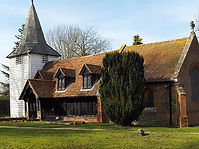
Chipping Ongar includes the Ancient Monument of Ongar Motte and Bailey Castle and Medieval Town Enclosure. Most of the Listed buildings lie within Chipping Ongar Conservation Area centred round the Medieval town enclosure and High Street with the remainder in the outlying settlements of Greensted, Marden Ash and Shelley. The oldest wooden church in the world is St Andrews at Greensted and is part of the Church and Manorial Hall complex at Greensted with a Group Listing.
Great Stony Conservation Area conserves the architectural layout of previous school and residential buildings round a circular green. The major feature is the symmetry of adjacent buildings and care must be taken when considering extensions to individual homes and how this may unbalance the symmetry. An Article 4 Direction to prevent Permitted Development Rights is recommended of the local planning authority.


Greensted Church (left), the inner bailey (middle-right) and moat and motte (right) of Ongar Castle are three of Ongars hidden historic monuments. Work in the Action Plan aims to open these up to more visitors.
A number of newer 20th century buildings, especially 1960s builds in the town, just prior to the conservation status, have had a detrimental effect on the quality and setting of Designated Heritage Assets and the Chipping Ongar Conservation Areas generally, as noted in the Chipping Ongar Conservation Area Appraisal 199867. Ongar Neighbourhood Plan policies aim to ensure that further infill development is in keeping with the character of the surroundings and does not detract from the Setting or function of Listed Buildings. This is supported by a number of national initiatives, Planning Policy frameworks and reports including:
-
Paragraph 190 of the NPPF 2021 endeavours to sustain and enhance the historic environment to bring social, cultural, economic and environmental benefits and improvements to local character and distinctiveness.
-
Building Better, Building Beautiful Commission Interim Report July 2019 [68] – Section
9.3 Access to Nature, and BBB Report January 2020.
-
National Design Guide, MHCLG, October 2019 & rev ed. 2021; and National Model Design Code 2021
-
Planning practice guidance, MHCLG, 2016
Designated Heritage Assets are protected through the NPPF and in EFDC emerging Local Plan Policy DM7.
EFDC emerging Local Plan’s Approach to Heritage Assets Paragraphs 4.58 to 4.64 supports the NPPF and requires in: -
-
that the “Council will take periodic reviews of its designated and non-designated heritage assets and introduce additional levels of protection, such as through the use of Article 4 Directions” ….” where justified.”
-
“A heritage statement is required” to cover several aspects.
Ongar Neighbourhood Plan policies go further by appreciating that the historic character of a place is the group of qualities derived from its past uses that make it distinctive. Thus, in considering any new developments, extensions or changes to exterior of buildings, it must ensure that heritage assets and their settings are protected or enhanced. This may include: visual aspects, architectural features, materials, and spaces associated with its history, including its original configuration and subsequent losses and changes.
‘Setting’ is different from the concepts of curtilage, character and context and frequently misunderstood. The NPPF makes it clear that the setting of a heritage asset is the surroundings in which a heritage asset is experienced. Its extent “is not fixed and may change as the asset and its surroundings evolve”. In a townscape, ‘setting’ will include space in the vicinity of the heritage asset and its purpose. In the context of Chipping Ongar, careful consideration of ‘setting’ must be included in any proposal including proposals to change the space, such as developing within old coaching inns, stable yards or workshop areas. In the Great Stony Park Conservation Area, that includes extensions and conversions that destroy the symmetry.
Even if a building is not itself listed as a Designated Heritage Asset, as defined in the NPPF, it may be within the ‘Setting’ of a Listed Building or group of Listed buildings. Particular attention will therefore need to be made to any change that requires planning approval or certificate, in order not to harm a Listed Building directly or to harm the Setting, as well as to protect the provenance.
Whilst it is important to ensure that listed buildings can provide a function suitable for today’s needs, it is also important to retain the features for future generations. Thus, only sympathetic materials will be expected to be used in alterations and extensions.
Similarly, trends change in demand for different uses and sizes of rooms. Should partitions of rooms for example, be required to suit today’s purposes, such building works must not harm features such as covings or architraves. This can be achieved by ensuring partitions etc butt up to and go round such features, instead of cutting into them. In order to be able to enjoy historic buildings today, enabling reversible alterations will ensure that future generations will also still be able to benefit from those buildings, even as trends inevitably change again for how buildings can be used. In building construction terms, this is a workable requirement. This would enable Paragraph 189 of NPPF 2021 to be applied to the benefit of Ongar, recognising that our Heritage Assets “are an irreplaceable resource, and should be conserved in a manner appropriate to their significance, so that they can be enjoyed for the contribution to the quality of life of existing and future generations”. The desirability is for buildings to be used rather than to be left unoccupied and become in disrepair

Extract from Chipping Ongar-Conservation Area Appraisal 1998 EFDC
POLICY ONG-ED3: HISTORIC BUILDINGS
-
The reinstatement of historic buildings (listed buildings or buildings in conservation areas) to a more original state, based on evidence, will be supported, unless the previous alterations contribute to the special architectural or historic interest of the building or area.
-
Extensions to listed buildings must be subservient in scale, height and positioning and avoid obliterating features which contribute to the special architectural or historic interest of the building or harming its Setting.
-
Development affecting the setting of listed buildings must preserve or enhance that setting, including complementing the existing townscape character, in accordance with Policies ONG-ED1 and ONG-ED2. Development will not be supported where it would compromise historic spaces within the setting of a listed building, including historic enclosed yard spaces.
-
Development in conservation areas must preserve or enhance the character or appearance of the area, including complementing the existing townscape character, in accordance with Policies ONG-ED1 and ONG-ED2.
-
New buildings and extensions involving listed buildings and their Setting or Conservation Areas must demonstrate a high standard of detail and finish, including constructional detail and degree of recession of openings. Where plans contain insufficient detail to demonstrate a high standard of detail and finish, more detail must be requested and received before a decision is made.
INTERPRETATION OF ONG-ED3
The policy adds some detail to national and Local Plan policies to guide the alteration and extension of historic buildings. It also guides the application of the special statutory duties for Conservation Areas and Listed Buildings under the Planning (Listed Buildings and Conservation Areas) Act 1990.
It is recommended that Historic England publications including Making Changes to Heritage Assets Advice Note 2 are referred to. In addition Designated Heritage Assets will need to meet requirements for Listed Buildings Consent. Historic England also provides advice. In the case of extensions, use of light-weight construction with extensive use of glass can be a way of minimising the impact on historic fabric.
The requirement for alterations to be reversible means that new insertions should avoid cutting into historic fabric. For example, a new wall to sub-divide a room should be contoured to fit around moulding, rather than cutting through those mouldings.
A high standard of detail and finish is expected, including for example to window recesses. Thus complete construction details will be expected, conveying accurate information of a specific nature, with a planning application. Comprehensive details can be shown on large- scale drawings and cross sections of the parts, such as window recesses. Constructional detail requires specifications of detail of the finished design. This is essential to gain a fuller, more precise understanding of the work to be carried out.
To allow for proper consideration of development proposals, new buildings and extensions should be shown on plans relative to existing buildings, including 3D visuals. The design and access statement and, where applicable, Heritage statement provide opportunities to explain how the requirements of the Policy have been complied with, including drawing material from Ongar Design Guide, the National Design Guide and National Model Design Code, and Heritage England’s documents.
SUSTAINABLE DESIGN
Sustainable design will ‘create better places in which to live and work and helps make development acceptable to communities’ NPPF 2021 [69]. Design will involve meeting the needs of future generations without compromising the needs of present populations. The three overlapping objectives [70] are:
-
economic-providing sufficient land in the right place;
-
social- to support inclusive safe environments and open spaces for health, social and cultural well-being, without overcrowding;
-
environmental- by protecting and enhancing the natural, built and historic environments, minimising waste and pollution and adapting to climate change.
An emphasis on place shaping principles is expected. [71] New development should relate to the existing character and ‘context’ of Ongar. Ongar Design Guide 2019 (AECOM) details the sub areas within the civil parish. ‘Creating Space for Beauty’ [72] and ‘Living with Beauty’ [73] January 2020 reports recognise the link between well-being and good planning. These and Building for Life 12 [74] have also informed this policy and related policies in sections 6.4 and 7.2.
In Section 7.2 Local Character and Design, policies cover immediate context, height scale, massing, materials and landscaping. In the built up parts of Ongar, the prevailing character and pattern are of single and two storey homes in tree and grass verge lined looping streets, with low boundary treatment, open green spaces with natural surveillance and views to the countryside beyond. The few 3 storey blocks of flats are only in the town centre or by shopping parades. In Section 6.4 policies cover housing mix, density and space standards to retain a viable cohesive and sustainable community to cater for growing families attracted to Ongar for the rural location with good primary and secondary schools.
Sustainable design policies support the creation of a safe and secure environment, with natural surveillance and active frontages, including road layout, footpath design, communal areas, dwelling boundaries, car parking. Secured By Design Homes 2019 (SBD), an Official Police Security Initiative provides design and layout advice for developments on active surveillance in addition to the expected individual door locks and other home security aspects. Design for Ongar must ensure that the car does not dominate the street scene. Ongar’s rural location and other factors [75] necessitates a high level of reliance on private transport including cars [76]. Sufficient off-street car park provision must be included in the design of all new developments and extensions, as well as electric vehicle charging points. [77] See Transport Section 8 and Policy CT3
There is opportunity to build beautifully designed homes with sufficient internal space for comfortable family living and good sized gardens to promote well-being, within a rural setting.
Applying character, place shaping, layout, open space and housing mix to a site will determine the density and housing numbers and also lead to sustainable development with the right home in the right place. The Local Plan allocated sites have an approximate housing number as a guide, but applications must meet the parish housing mix and prevailing character. Cramming or inappropriate urbanisation to this rural location does not comply with national and local planning law and guidance. At edge of settlement sites, environmental considerations on limiting harm to the wildlife and natural environment, and providing sustainable solutions on biodiversity and carbon offsetting must be included.
The context and character of adjacent area and housing will determine the final design and density [78]. The average density for the civil parish of Ongar is around 24dph, but EFDC baseline density for the district is expected to be 30dph. [79] Paragraph 2.88 of the Local Plan also acknowledges that it is not appropriate to apply density ranges set out in Policy SP3 mechanistically but to consider the density appropriate to the location. EFDC site selection reports on the Green Belt and Landscape Sensitivity, concludes that sites in Ongar are particularly sensitive to the impact of intensification and development because of the prevailing character of the area and the sensitive nature of the surrounding countryside or built form. Planning applications will be expected to justify the density range, housing mix and parking provision accordingly [80] with evidence. See also Section 6.4 and Policy ONG-RR3
Sustainable design should also ensure that new housing and outside space respects neighbours’ privacy and does not lead to overlooking or loss of private amenity space [81]. This is important for wellbeing and a good quality of life. Parts of the civil parish of Ongar are already considered to be deprived [82]. It is therefore important that new housing, including infill and conversions, does not lead to overcrowding or further deprivation or anti-social behaviour. Sufficient internal and outside private space in housing is important and achievable, as is accessible open space near new homes providing safe areas with active surveillance from nearby windows [83], reducing the opportunity for crime. SBD Housing 2019 provides guidance and checklist for developments, and SBD certification is encouraged.
The Landscape Characterisation reports for EFDC indicate that Ongar has a ‘high sensitivity to change’ and the functions of the Green Belt are also ‘strong’ [84] so this must be considered, to ensure any development is rural in character and does as little harm as possible to the prevailing character, including to the natural environment.
High quality design should always complement and reflect the local character of Ongar Civil Parish. This includes the finer detail of design and architecture. A high specification of design ensures and contributes to the distinctive character and amenity of the local area. See also EFDC Local Plan 2011-2033 DM 9 Policy DM9 High Quality Design – Section D. which relates design standards to contextual character.
Floodplains, underground springs and surface water drainage issues require careful management. Ongar’s geology is that of largely underlying clay, which naturally has poor drainage. There are many examples of areas within the parish which are particularly prone to surface water flooding as indicated on Government website mapping. See also ONG-ED 5 Natural Environment. More frequent heavy downpours as a result of climate change is exacerbating the issue. Mitigation against Climate Change effects, such as flooding and higher summer temperatures, should be included in new sites, including with the provision of trees to provide shading. [85]
In addition, all greenfield areas being developed should limit the area of impermeable hard surfaces. Loss of grass etc. and the additional impermeable area used for housing foundations will increase the runoff towards the remaining permeable surfaces, putting added stress on its natural drainage capability. This is likely to exacerbate Ongar’s surface water flooding issues. All other hard surfaces, including paths, patios, driveways and estate roads must be permeable to aid drainage. See also EFDC Local Plan Policy DM16.
High performance, energy saving buildings will improve the sustainability of the design, as will the use of local or recycled materials. Sustainable drainage ponds and mitigation of harm to wildlife and net biodiversity gain will be expected for greenfield sites. See also Natural Environment Section 7.6
In addition to reducing energy use and carbon emissions, good urban design implies a much more profound basis on which to make decisions that impact on people’s lives and the social, economic and environmental sustainability of the built environment.
POLICY ONG-ED4: SUSTAINABLE DESIGN
-
All development must be well-designed and sustainable. This includes:
-
Incorporating active frontages (doors and windows) to street frontages and spaces, so as to provide natural surveillance to the public realm;
-
Providing a clear separation between public and private space in the layout of development, avoiding the need for high enclosures which would create blank frontages to the road;
-
Incorporating sufficient spacing around properties to allow for building maintenance and to ensure privacy and no overlooking;
-
Ensuring all hard surfaces, other than foundations of buildings, are permeable wherever possible, to allow surface water penetration;
-
Ensuring discrete provision is included for bin stores, which must be screened.
-
Ensuring car park spaces and electric charging points are included early in the design stage, in accordance with Transport Policies ONG-CT3.
-
Incorporating a high-quality public realm which is not dominated by cars, and which provides an attractive, safe and convenient environment for pedestrians, social interaction and play;
-
Ensuring landscape design is a positive and integral part of the layout, including tree planting;
-
Incorporating sustainable (urban) drainage systems into the landscape design of new housing, including ponds, and taking opportunities to enhance wildlife and biodiversity.
-
-
Particular support will be given to development that Incorporates features to reduce environmental impact, such as water collection, use of local or recycled materials or high-performance buildings.
-
Development must not take place in flood risk areas, unless specifically designed with measures to mitigate the risk or impact of flooding.
INTERPRETATION OF ONG-ED3
This policy should be applied together with the other design policies in this Neighbourhood Plan in Section 7 and Section 6.4 in particular. The policy emphasises the pedestrian experience. Designs with natural surveillance on to open spaces and streets is inherent in reducing anti-social behaviour and vandalism [86]. Justification of the density of new developments will be expected to indicate that the prevailing character of the area is maintained. 3D visuals will be encouraged.
The required Design and Access Statement of a planning application provides opportunities to explain compliance with the requirements of the policy.
‘Development including new layout (roads and footpaths)’ includes, not only EFDC Local Plan allocated sites, but also smaller developments that involve an access road to new developments.
Aspects on density are also covered in Section 6.4 Housing Mix and Standards, Policy ONG- RR3. Section 7.2 Local Character and Design and Policy ONG-ED1. Car parking space requirements are in the Transport section 8.4, Policy ONG-CT3.
RATIONALE: NATURAL ENVIRONMENT
A number of recent UK Government papers and policies on the Environment and Climate Change [87] have led to details of how the natural environment can be protected. This includes mitigation when greenfield land is built on for new homes with details in NPPF 2021, National Design Guide 2021 and National Model Design Code 2021. ECC and EFDC have both produced a Green and Blue Infrastructure Strategy [88] with a variety of proposals.
This is particularly relevant for the civil parish of Ongar because all new developments proposed in EFDC Local Plan 2011-2033 are on greenfield sites, at present in Green Belt. Ongar already has a low tree coverage; the area is subject to regular flooding both due to the two local rivers as well as surface water flooding because of underlying heavy clay soils; and the network of underground springs. The sites ONG R1-R8 are largely on well wooded sites or with good pasture, both of which are recommended to mitigate against climate change. Each of Ongar’s allocated sites presents specific issues on how to accomplish net biodiversity gain due to the considerable documented wildlife, its habitats and ecosystems in the civil parish. Ongar environs has been relatively unchanged for centuries, although changes in farming methods over the 50 years has caused hedges, tree coverage and some habitats to be destroyed, with subsequent reduction in some longstanding wildlife.
This policy seeks to ensure that further building does as little damage to our natural environment as possible and to preserve our rural setting. Further detail on our existing environment is as follow, together with some mitigating steps required.
Our local landscape has scattered settlements within a longstanding agricultural landscape The landscape has high sensitivity to change [89]. The small town of Chipping Ongar built up round the medieval motte and bailey Castle on a ridge of land between the two river valleys of the Roding and the Cripsey, with their confluence between Chipping Ongar and Marden Ash. Sections of these water courses have flood plains within or close to existing homes and there is a record of flooding for decades. These water courses are included in the Roding, Beam & Ingrebourne Catchment Plan [90] to prevent flooding of the Capital, so that solutions to Ongar’s existing flooding are complex. Furthermore, proposed and recent new developments up river of the Cripsey and Roding will further exacerbate flooding in Ongar in the future. The Cripsey Brook’s catchment up stream includes the Epping Forest ridge with the highest recorded precipitation in Essex. More frequent heavy downfalls cause serious flooding on the access roads to Ongar and widespread surface water flooding [91].
The underlying soil type for Ongar is London Clay. This is overlain with some deposits of a mix of gravels, sand, silt and clays. There are abundant seepage lines or springs on sloping hillsides of the rivers and throughout the civil parish. Agricultural Land Classification for Ongar are Grade 2 (very good) and Grade 3 (Good to Moderate) and predominantly farmed for cereal production, but waterlogging is an issue on the heavier clays. Some fields have had land drainage installed to improve drainage.
In view of the complex system of underground springs in the area and underlying poor permeability of the heavy clay soils, any planning applications involving excavation such as for basements and including for existing buildings, must have accompanying analysis and reports to indicate avoidance of such water courses or subsequent localised flooding as a result of the said proposed development. Further suggestions to mitigate against climate change and flooding are included in the National Model Design Code including sustainable drainage details with permeable surfacing, retention tanks, reedbeds and wetlands etc. See also Section 7.5 and Policy ONG-ED4 Sustainable design.
Changes in farming methods since 1945 has resulted in a loss by 75% of the ancient hedgerows to the east of Chipping Ongar and a reduction in farmland biodiversity generally. Dutch Elm disease and Ash die back have taken their toll and also caused fragmented and gappy ancient hedgerows, which are species rich and have high biodiversity potential.
Ongar’s patchy woodland, small copses, and water courses with respective flood plains together are ideal Green Corridors [92]. However, Ongar has only 6% land coverage as woodland, being below the 10% average for England. There is a wide range of native tree species in Ongar [93], many being Ancient and Veteran trees. Ancient Woodlands such as Greensted Wood and various Ancient Hedgerows offer particular value to the environment and must be retained. Where otherwise, or diseased trees are felled, suitable replacements must be planted and maintained. Indigenous Trees and hedgerows provide the habitat for indigenous invertebrates (including insects, spiders and worms), which in turn feed other indigenous animals (including birds, mammals reptile and amphibians).
The national tree planting scheme, adopted by EFDC is supported. Benefits of such vegetation are now well documented, including within urban environments for shading and flood prevention. Landscape Design in Planning applications must include frontages with hedges and trees including tree lined streets. The National Model Design Code 2021 Part 2 Guidance Notes gives detail and states:-
“57. Development should enhance the natural as well as the built environment. Nature is essential for health and wellbeing, for biodiversity, shading and cooling, noise mitigation, air quality and mitigating flood risk as well as contributing to tackling the climate emergency. Nature is also central to the creation of beautiful places.
“58. Design codes need to ensure that nature and the historic landscape is woven into the design of places. This may include the amount and type of open space, the response to flood risk and the protection, enhancement and promotion of biodiversity.”


Many footpaths pass through our rich green corridors
The rich range of wildlife around Ongar needs clean, green, natural spaces to thrive.
Ongar is fortunate in having several protected species, both European Protected Species [94] (including all bats and Great Crested Newts) and UK protected amphibian species [95] (such as Slow Worm, Grass Snake, Common Lizard) and protected mammals such as Badgers. Ongar’s woods and hedges provide habitats for songbirds protected under the 1981
Act. Birds of prey, including buzzards, the red kite and various owls including the Barn Owl are regularly noted within the countryside, as are other animals including the Fox, Hare, Rabbit, Mole, Field and Harvest Mice, Water Vole, Muntjac Deer and Fallow Deer. Sightings of Otters have been seen, but Hedgehogs are much reduced in recent years.
Illumination of habitats through external lighting and street lighting disrupts the time limited feeding patterns of protected bats in particular. Although street lighting is often required to reduce crime and personal safety, this must be avoided. This could be achieved using of appropriate low level and low energy lighting with downlighters.
Ongar’s rich biodiversity is vulnerable to climate change and also to development. Environmental policies in the EFDC Local Plan 2011-2033 [96] also help to address this vulnerability.
Our rural setting and protection of its wildlife is important to local residents [97]. Long- established networks of footpaths and bridleways [98] offer access to our attractive countryside. Furthermore, 93% of the Residents’ Survey respondents considered that provision of Green Corridors for wildlife and maintaining the natural habitat could lessen the impact of development on the environment. The National Model Design Code Section N Nature includes biodiversity design principles and examples to include in developments.
Air quality is important in the conservation of the natural environment; pollution and poor air quality is also detrimental to our health and well-being. Having sufficient trees is one of the ways helping to address poor air quality. Trees and hedges help to filter out damaging chemicals from the traffic fumes [99]. Such planting with appropriate species alongside busy roads can reduce pollution levels and is to be encouraged in Ongar Civil Parish. Where new homes face or back on to the busy A414 (including ONG R1/2 West Ongar Concept) or Chipping Ongar High Street, sufficient planting of appropriate hedging and trees will be required edging the highway to help filter out pollution.
Whilst acknowledging that all development on greenfield sites will have an adverse effect on the green environment, development plans for Ongar must indicate what measures will be taken to protect or rehome existing wildlife and their habitats, increase biodiversity [100] and ensure future stewardship. Planting of street trees, hedges and grass verges will be expected to help mitigate against climate change and poor air quality. Mitigating against climate change is complex. However, the use of high performance, low carbon footprint materials will be expected as will planning applications that comply with the National Model Design Code 2021 or subsequent revisions and current Government Environment Policy.
POLICY ONG-ED5: ENVIRONMENT
-
Development must enhance or have no unacceptable adverse impact on the rural and natural environment of Ongar and on local water courses, ponds, wildlife habitats, biodiversity and eco-systems. This includes:
-
Retention of ancient woodlands, hedgerows and veteran trees
-
Maintaining the open and rural setting of Chipping Ongar and other rural settlements and avoiding coalescence;
-
Ensuring that any external lighting avoids illumination of wildlife habitats;
-
Avoiding interruption of underground springs, including through the insertion of basements to existing buildings.
-
-
To meet the requirements of this policy, any adverse environmental impact of development should be offset by incorporating positive environmental features, such as:
-
High quality landscape design, in particular the use of trees and planting to address air quality and create net gains in biodiversity;
-
Replacing felled trees with suitable additional trees and shrubs
-
High performance buildings with low energy-use requirements;
-
Use of green features, such as green or brown walls or roofs;
-
Features to support biodiversity, wildlife and ecology.
-
INTERPRETATION OF ONG-ED5
New planting of trees and hedges, using indigenous local species will be encouraged and new streets will be expected to be tree lined. See also Policy ONG-ED1 Local Character.
Features to support wildlife and ecology could include bird boxes, bat boxes, swift bricks and hedgehog gaps in fences. Providing Green Corridors for wildlife to link with open countryside is to be encouraged in developments. Local species are listed within the Rationale of this Policy. Semi natural open space provided within a development could include a wildlife pond and areas of wildflowers or meadows.
See also ECC and EFDC Blue and Green Infrastructure Strategy [101]
RATIONALE: LANDSCAPE AND AMENITY BUFFER ZONES
Most strategic sites in EFDC Local Plan for Ongar are immediately adjacent to existing edge of settlement homes. Many of these have very short gardens, but a compensating open view to the countryside beyond, which until now was in the Metropolitan Green Belt and thus protected against building. New development adjacent to these existing properties must respect their residential amenity and lessen the effect of loss of openness and views.
New homes overlooking these properties and gardens should be avoided within the layout and design of any new greenfield site. Some of the open space requirement within an allocated site could be situated close to the boundaries of existing homes and a mixture of trees and hedge planted. Early public consultation with affected household groups will be expected, as well as with the Statutory Consultees [102] of Ongar Town Council and its Neighbourhood Plan Steering Group ONPCG, prior to formal detailed planning application, in order to achieve the best possible solution.
A Buffer zone will be expected where any new development flanks existing properties. Development sites will be expected to provide suitable detail to ensure that existing neighbouring properties are not overlooked, overshadowed or have their level of light compromised.
West Ongar Concept Framework Plan [103] has specific requirements. “It is located in an area of high landscape sensitivity. Development proposals should be carefully designed to minimise harm to the wider landscape taking into account the development’s setting in the landscape and the local landscape character…” [104] ONG.R2 (land at Bowes Field), is one of two sites in the west Ongar Concept Framework, allocated as part of EFDC Local Plan 2011-2033. The open space requirement for this site should include a landscape buffer to properties that were formally flanked by green belt land [105]. Most properties in Great Lawn and The Pavilions in particular, have very shallow rear gardens. The landscape buffer must be able to adequately protect residential amenity including light, privacy, and overlooking. It would also act as a wildlife corridor and a positive resource in terms of wildlife and biodiversity, to help offset the impacts of the development.
The approach access road into the new estate from Chipping Ongar High Street along the strip, should form part of the landscape buffer and include landscaped trees and shrubs or hedging at the sides and adjacent to existing homes of The Pavilions. By being more vegetated, the access would also provide a more inviting approach than usual housing estates, whilst respecting the rural character of the neighbourhood.
POLICY ONG-ED6: LANDSCAPE BUFFERS
-
Development that flanks existing housing must include sufficient landscape or garden separation to protect the amenities of the occupiers of that housing.
INTERPRETATION OF ONG-ED6
The policy is especially important where existing housing has short rear gardens, so that loss of open space behind could create harm to amenity through proximity and overlooking.
The policy highlights the importance of landscape design as an integral part of site planning. To fulfil the requirement to create a landscape buffer by existing homes, the planning should include taller species, in addition to smaller planting and ground cover. This would enable effective implementation of EFDC Local Plan 2011-3033 including DM9 High Quality Design Section, Privacy and Amenity H(ii)&(iii).
For Part 2 of the Policy, Site ONG.R2 (allocated in EFDC Local Plan) is part of the West Ongar Concept Framework Plan and should be applied to the south and east boundary of ONG.R2 where development is adjacent to existing housing. Theses existing properties were built with very short gardens but adjacent to Green Belt protected recreational space. This necessitates careful consideration of separation of properties to avoid harm to amenity
Where landscaping is provided, it is important for there to be longer-term arrangements for maintenance.
See also Section 7.2 Local Character and Design and Policy ONG-ED1
47 See Evidence File Ongar Design Guide AECOM 2019
48 See National Design Guide 2021https://www.gov.uk/government/publications/national-design-guide National Model Design Code 2021https://www.gov.uk/government/publications/national-model-design-code 49 AECOM Ongar Design Guide 2019 see evidence file
50 EFDC Chipping Ongar Conservation Area leaflet 1998 see evidence file
51 National Design Guide 2021 MHCLG https://www.gov.uk/government/publications/national-design-guide National Model Design Code 2021 https://www.gov.uk/government/publications/national-model-design-code
52 Residents Survey 2018 see evidence file
53Including NPPF https://www.gov.uk/government/publications/national-planning-policy-framework—2 National Design Guide 2021https://www.gov.uk/government/publications/national-design-guide National Model Design Code 2021https://www.gov.uk/government/publications/national-model-design-code Planning for the Future 2020 https://assets.publishing.service.gov.uk/government/uploads/system/uploads/attachment_data/file/872091/P lanning_for_the_Future.pdf https://www.gov.uk/government/consultations/planning-for-the-future
Living with Beauty 2020https://www.gov.uk/government/publications/living-with-beauty-report-of-the- building-better-building-beautiful-commission , Housing Design Audit for England 2020 https://indd.adobe.com/view/23366ae1-8f97-455d-896a-1a9934689cd8
54 EFDC Local Plan Hearing Sessions records https://www.efdclocalplan.org/local-plan/hearing-sessions/ , 2019 of EFDC Local Plan submission version, where the wording of minimum indicative Housing numbers could apply to MasterPlans, but only approximate housing numbers for other allocated sites. Representations had queried the accuracy and depth of analysis of some of the allocated sites. (verifiable by attendees and recordings).
55 See evidence file for response by EFDC Chief executive to Alex Burghart MP case ref AB17683 relating to the District Housing Mix
56 Ongar Design Guide (AECOM) 2019 See evidence file
57 National Design Guide 2019 https://www.essexdesignguide.co.uk/
58 The Essex Design Guide is an on line guide https://www.essexdesignguide.co.uk Home | Essex Design Guide
59 Residents Survey 2018 see evidence file
60 EFDC Chipping Ongar Conservation Area Appraisal 1998 by Maria Medlycott see evidence file https://www.eppingforestdc.gov.uk/wp-content/uploads/2019/01/chpping-ongar-conservation-area.pdf
61 Projects and Actions is an Appendix to the Ongar Neighbourhood Plan
62 See Natural Environment section7.6 and Policy ONG-ED5
63 See Section 8.4 Transport and Movement and Policy ONG-CT3
65 Streets for All https://historicengland.org.uk/images-books/publications/streets-for-all/ and Manual for Streets
https://assets.publishing.service.gov.uk/government/uploads/system/uploads/attachment_data/file/341513/p dfmanforstreets.pdf Manual for Streets 2 https://tsrgd.co.uk/pdf/mfs/mfs2.pdf
66 These lists are available through EFDC website https://www.eppingforestdc.gov.uk/planning-and-building/built-heritage/listed-
buildings/#:~:text=There%20are%20over%201%2C300%20listed%20buildings%20in%20the,such%20 as%20village%20pumps%2C%20bridges%20or%20telephone%20kiosks.
67 EFDC Chipping Ongar Conservation Area Appraisal 1998 see evidence filehttps://www.eppingforestdc.gov.uk/wp-content/uploads/2019/01/chpping-ongar-conservation-area.pdf
68 Building Better, Building Beautiful Commission Interim Report July 2019 https://www.gov.uk/government/publications/living-with-beauty-report-of-the-building-better-building- beautiful-commission
69 NPPF 2021 https://www.gov.uk/government/publications/national-planning-policy-framework--2 See evidence file including chapter 12 achieving well designed places and paragraph 129, 139 and 131 in particular 70 NPPF 2021 Ch. 2 and Para 8
71 EFDC Local Plan 2011-33 on Design para 4.69
72 BBBB Interim Report ‘Creating Space for Beauty’ July 2019
73 BBBB Report ‘Living with Beauty’ Jan 2020 https://www.gov.uk/government/publications/living-with-beauty- report-of-the-building-better-building-beautiful-commission
74 Building for Life 12 see evidence file http://www.builtforlifehomes.org/go/about
75 Including lack of local employment, varied employment hours, use of company cars and vans, lack of economically viable public transport as sources from NOMIS and ONS- see also Transport Section 8
76 ONS figures show that Ongar households have 20% higher car ownership of 2+ vehicles than England’s average
77 State of the Parish Report Navigus (in evidence file) and ONS statistics.
78 which is supported in the NPPF 2021
79 EB801 ARUP Site selection reports
80 See evidence file Letter from EFDC Chief Executive to require evidence for any deviation from housing mix
81 See various national standards for proximity of residential housing in the evidence file
82 ONS statistics; EFDC review of Shelley 2009 in Evidence file; Well-being Survey 2020 EFDC in Evidence file. Shelley is in the 2nd lowest national decile of deprivation
83 See examples in Ongar Design Guide 2019
84EB709/712 EFDC Land Characterisation and EB704/705 EFDC Green Belt Review and EB801 https://www.efdclocalplan.org/local-plan/evidence-base/
86 See Secured By Design Housing 2019 ( Police initiative) in evidence file
87 See UK Government on Environment Policy and Bill and Climate Change Policy and Act
88 ECC Green Infrastructure Strategy https://www.essex.gov.uk/protecting-environment EFDC Green Infrastructure (draft 2020) https://www.eppingforestdc.gov.uk/wp- content/uploads/2020/06/Draft%20green%20infrastructure%20strategy.pdf
EFDC Green Infrastructure Strategy Implementation EB159D https://www.efdclocalplan.org/wp- content/uploads/2021/07/EB159D-EFDC-Green-Infrastructure-Strategy-LLD-2.pdf
89EB709/712 EFDC Land Characterisation and EB801 https://www.efdclocalplan.org/local-plan/evidence-base/
90 Roding, Beam & Ingrebourne Catchment Plan see details in Evidence file
91 The Cripsey Brook catchment covers some 50.6km2. Its 16.3km course flows through an undulating productive agricultural landscape. The water level monitoring gauge is at Banson’s Lane. Catchment covers higher ground east to the Epping Forest ridge where the precipitation is the highest in Essex with an average of 679mm. The wettest year was 2000 when 974mm of rain was recorded. Climate change impact on rainfall patterns results in more frequent and heavier downpours, flooding is likely to increase with rising water levels across the catchment causing serious flooding on the access roads to Ongar and widespread surface water flooding. Extracted from Environment Agency Website see also Thames River Basin Management Plan https://www.gov.uk/government/organisations/environment-agency
92See detail in Section 8.2 Local Green Space and ONP Projects and Actions Appendix
93 Ongar Tree Strategy see EFDC Evidence Base EB1005 https://www.efdclocalplan.org/wp- content/uploads/2018/02/EB1005-Ongar-Community-Tree-Strategy-EFDC-2008.pdf
94 Habitats Directive/Conservation of Habitats and Species Regulations 2010.
95 Wildlife and Countryside Act 1981
96 EFDC Local Plan policies on: Natural Environment and Green Infrastructure; Protected Species, Priority Species and Priority Habitats; Tree Protection; Protection, Enhancement, Management and Monitoring of Biodiversity; Landscape Character and Features; and Green Buffers.
97 See Residents Survey 2018 in the evidence file 90% agreed/strongly agreed that access to the countryside was good
98 See Section 8.6 and Policy ONG-CT5 Footpaths and Cycle Routes and OS map of the civil parish
99 See details on particle filtration in Beckett K P, Freer-Smith P and Taylor G (2000) Journal of Arboriculture 26 (1), 12-19.
100 Net gains for biodiversity is contained within the NPPF. A new set of standards has been developed by Building with Nature which will be useful in complying with the policy. .
101 ECC Green Infrastructure https://www.essex.gov.uk/protecting-environment and EFDC Blue and Green Infrastructure Strategy https://www.eppingforestdc.gov.uk/wp- content/uploads/2020/06/Draft%20green%20infrastructure%20strategy.pdf
102 This is a requirement in EFDC Local Plan para 2.102 for sites delivering 50 or more homes
103 A Concept Framework Plan involves two or more adjacent allocated sites. The development and infrastructure in a coordinated way between the interested parties and endorsed by EFDC prior to submission of any planning applications. For more information see EFDC Local Plan 2011-2033 and its Glossary
104 EFDC Local Plan Appendix 6 Site specific Requirements for Site Allocations
105 The land was used for decades as recreational area for an orphanage and then special school.